Multimodal Data Set for Portland Oregon Region
Test Data Set for the FHWA Connected Vehicle Initiative
Real-Time Data Capture and Management Program


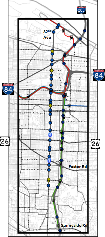
The Portland State University Multimodal Test Data Set submission contained on this website consists of freeway, transit and arterial data for the I-205 corridor in Portland, Oregon. The selected corridor ranges along the I-205 Freeway from Sunnyside Road near milepost 14 to the end of the detection, near the Oregon/Washington State line. The corridor is approximately 10 miles long. The figure below displays many of the data sources that are included in the data set submission. The data set contains freeway loop detector data, weather data, incident data, arterial count data, signal phase and timing data, limited Bluetooth travel time data, and bus and light rail data. I-205 is the major north-south freeway in the corridor and 82nd Avenue is the primary north-south arterial. Transit service consists of buses running along and across 82nd Avenue and light rail lines running along the I-205 freeway. We provide a two-month multimodal data set for use in testing connected vehicle applications.